
Stop guessing what’s in your field
Get precise aerial maps that reveal rocks and hazards before it costs you.
Find Problems Before They Find You
Without accurate field data, you’re making decisions blind.
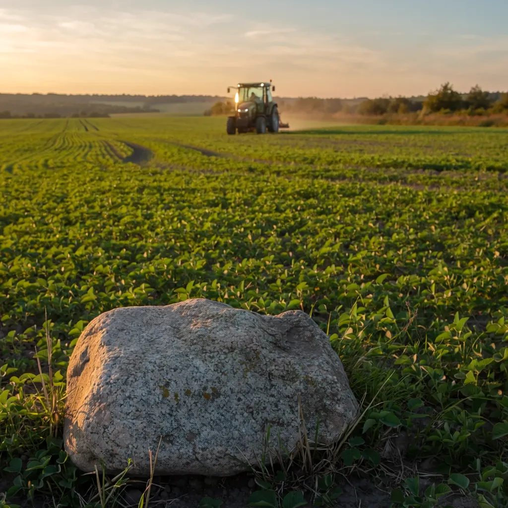
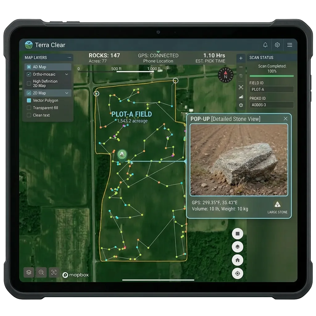
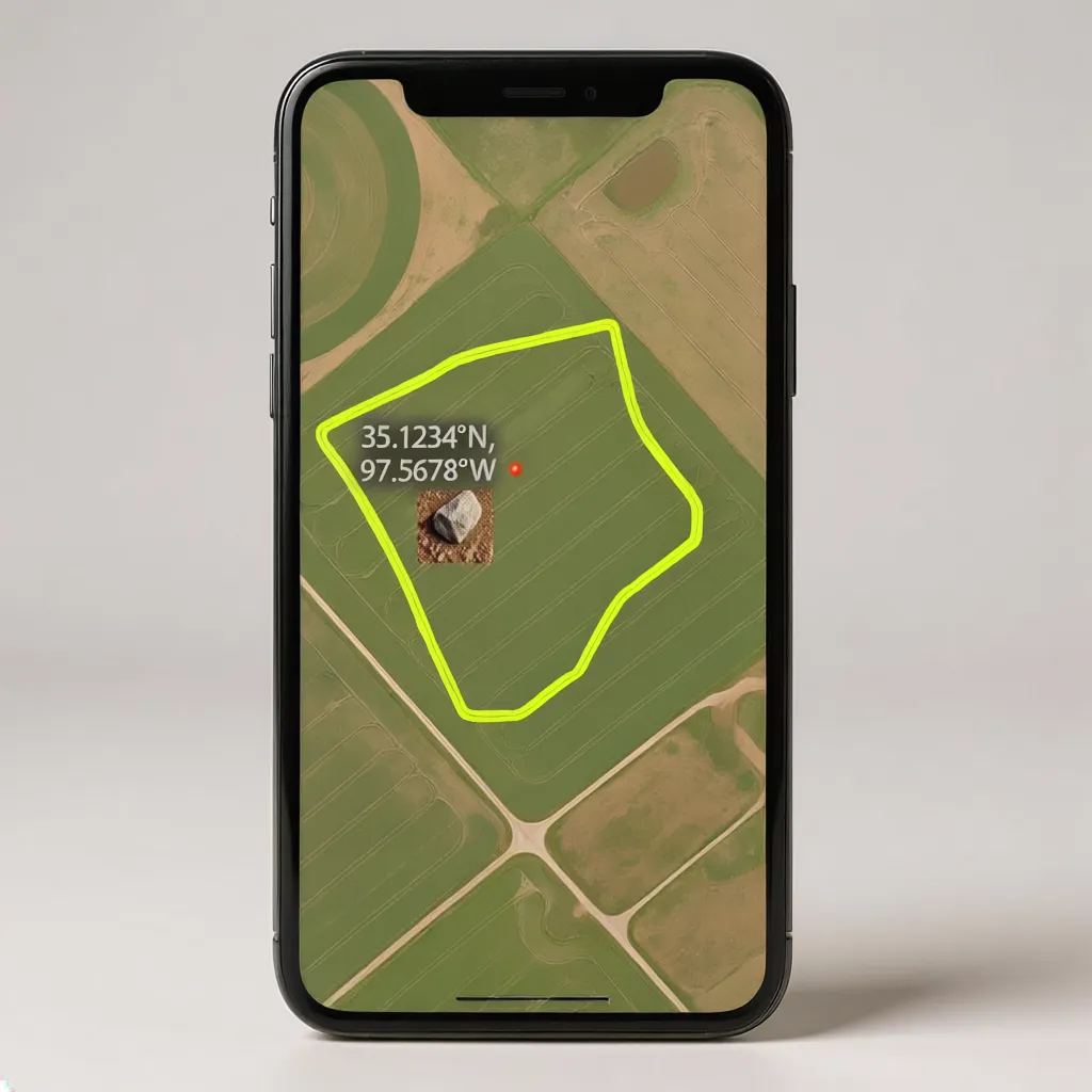
Locate Hazards with Precision
High-resolution drone mapping that reveals hidden rocks and hazards so you can protect your equipment and farm with confidence.
Save Time.
Protect Equipment.
Maximize Every Acre.
With a clear view of your land, you avoid costly mistakes, keep your operation running smoothly, and get more done without setbacks slowing you down.
Get your field mapped in 3 easy steps
1. Mark your property
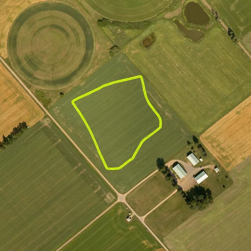
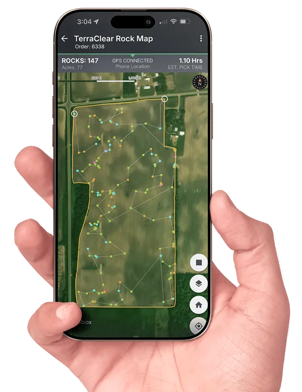
2. We Map & Identify Hazards

3. Get Your Precise Field Map
Built on Local Trust, Powered by Precision Drone Mapping
Aero Ag Drone Services is a locally rooted, small-town team built on a deep understanding of the land, the seasons, and the challenges farmers face every day. We’re not a distant tech company, we’re neighbors who know what it means when a missed rock can damage equipment or delay a whole planting season. Using high resolution drone mapping and precision imaging, we help farmers uncover what’s hidden beneath the surface so they can make faster, safer, and more informed decisions. Our work has supported growers across the region in reducing equipment damage, improving field efficiency, and gaining a clearer picture of their land than ever before. When you choose Aero Ag Drone Services, you’re choosing a team that values trust, reliability, and real results because your success is our community’s success.
Ready to see what we can do?
Get a free estimates of our rock-spotting and mapping services.
Map your property with our calculator in minutes.
Enter a few details about your land to get accurate results.
Receive a clear, upfront service estimate based on your land size.
AeroAg Service Calculator
Estimate spraying, granular, mapping, and travel costs
Spray Acres
Granular Acres
Mapping Acres
ZIP Code
Terrain Adder
Prepay %